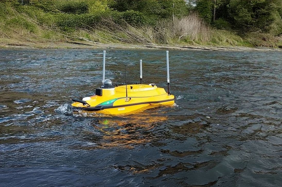
Woods delivers high-quality bathymetric mapping using a compact, remotely operated Unmanned Surface Vessel. Designed for complex coastal, riverine, and marine environments, our USV system captures depth and terrain data in areas that are often inaccessible or unsafe for traditional survey boats.
This is an efficient, low-impact solution for civil engineering, environmental management, and infrastructure projects and is particularly suited where shallow water, narrow access, or operational constraints exist.
Our bathymetric mapping services support a wide range of applications:
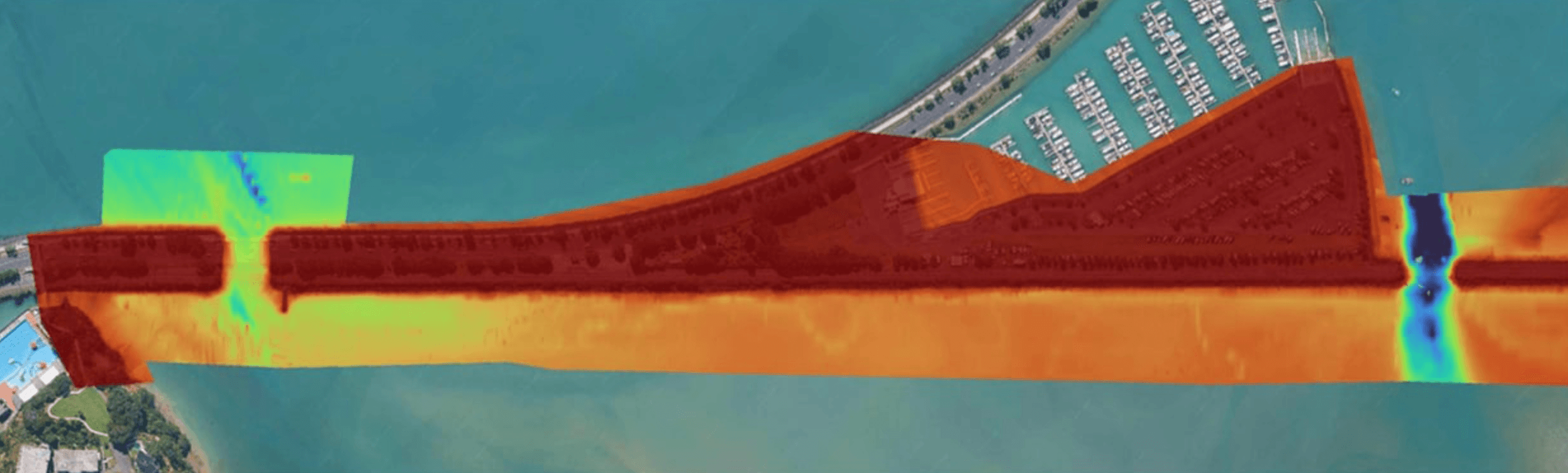
Harbour and channel surveys
River cross-sectioning and sediment studies
Dam and reservoir mapping
Dredging pre- and post-verification
Infrastructure inspections below the waterline
Environmental assessments and habitat studies
By removing the need for large vessels and survey crews, our USV approach enhances safety, cuts mobilisation costs, and allows for rapid deployment – even in challenging environments.
The Woods Unmanned Surface Vessel is equipped with a high-precision single beam echosounder, capable of measuring depths down to 200 metres with centimetre-level vertical accuracy.
Key features include:
Shallow draft operation. The USV works in as little as 0.35m of water, which is ideal for estuaries, streams, and nearshore zones
RTK GNSS and INS integration. This ensures georeferenced accuracy, even under bridges or overhanging terrain
Clean, repeatable datasets. Data is delivered in formats ready for engineering design, environmental reporting, or integration into GIS/BIM workflows
Our Unmanned Surface Vessel platform adapts to your needs, enabling detailed, survey-grade insights with minimal environmental impact and maximum data confidence. Talk to the Woods team about how bathymetric mapping can support your next project