Fri 7 March 2024

Due to the long history of underground utility installation and the evolving standards in New Zealand in documenting assets when they are installed, service plans can be far from reliable and won't always provide accurate information on the location of underground services such as water mains, power cables, gas lines, and communication services.
Underground service location and utilities detection reveals the location and depth of underground services in a safe, non-invasive manner to increase the safety of site investigations and the efficiency of design.
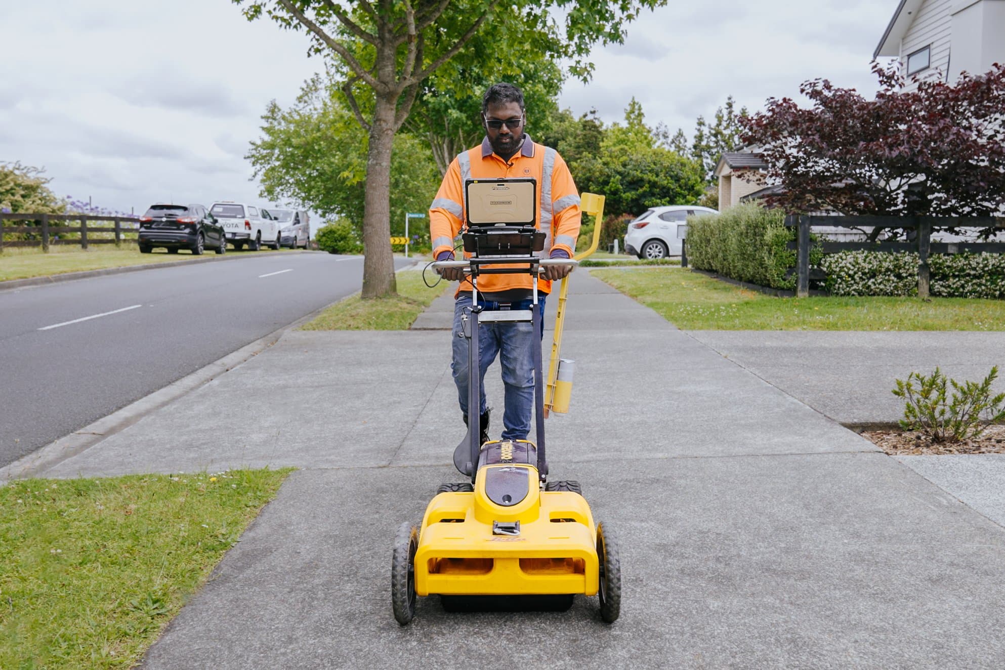
At Woods, we have a suite of leading-edge technologies available for our service locators to use when detecting and identifying underground services:
Electromagnetic Location (EML) and Electromagnetic Induction (EMI) are essential tools for locating underground services and utilities. EMI can be used passively to detect existing electromagnetic frequencies emitted by power lines and communication cables. Alternatively, active locating techniques involve inducing a current into conductive services or using a sonde (a long cable fed through services such as storm and wastewater pipes and conduits) to trace the path of underground pipes and conduits. Active EML uses a signal transmitter to generate and detect electromagnetic signals along the path of a utility, while passive EML relies on detecting existing signals. Both methods provide valuable information for understanding the layout and depth of underground infrastructure.
GPR technology uses radio frequencies to scan underground and detect anything in the ground material that sticks out as a potential service.
Although GPR is not directly an EMI method, it is often used in combination with EMI techniques to improve the accuracy of utility location. GPR can help identify non-metallic utilities, while EMI is more suited for metallic pipes or cables. We combine these technologies to logically work through the service plans and client data and locate or correct the location of underground services throughout the site.
PAS 128 emphasizes the need to use multiple techniques together to enhance the accuracy and reliability of utility detection. For example:
Survey Type D: Performing a desktop utility records search (non-intrusive), but typically used before EMI techniques.
Survey Type C: Site reconnaissance and passive detection, where passive EMI can detect the presence of utilities.
Survey Type B: Detection and mapping survey using active detection techniques, such as EMI, combined with other methods (e.g., GPR).
Survey Type A: Verification is performed by exposing the utility, typically done after the location has been detected using methods like EMI.
Our team also complete a walk-through of the site and look for anything that could be a clue as to the location of where services meet up underground such as valve lids, fire hydrant lids, and communication box lids.
The location of any utilities and services are marked using a safe, eco-friendly temporary spot marking paint (Soppec). We also have semi-permanent options for where markings are needed for longer than 2-8 weeks.
The main benefit of underground service location is safety. Clearing the area of services before commencing geotechnical investigations or construction protects the health and safety of employees, contractors, and the community.
Once construction begins, striking a service that has been overlooked or is inaccurately reported on the service plan can cost hundreds of thousands of dollars to repair and add lengthy delays to your project. Not to mention the disruptions, time, and financial cost for homes and businesses affected by service disruptions. Underground service location enables you to mitigate this risk and keep your project within budget and on time.
This additional information also enables you to plan the design and construction around the services or incorporate them into the design. Underground service detection helps you avoid discovering something later down the track that requires the designs to be changed.
One of the projects we have recently deployed this solution on is the Eastern Busway project - Auckland's second-biggest public transport project. Woods’ utility detection team worked with the geotechnical engineers on-site to locate and verify the location of critical services in the area. Locating these services enabled construction work to be completed safely further down the track as we designated areas where a 20-30m hole could be drilled for core sampling or to install a piezo for earth monitoring.
At this stage, New Zealand does not have a standard for locating and reporting underground services. Woods and many other companies in the industry have adopted the Australian standard AS 5488 in reporting and practice. However, this standard only requires detection of services within +/- 300mm horizontally and +/- 500m vertically. The equipment Woods currently has exceeds this standard of accuracy, but there is still room for further improvement. Woods has also adapted PAS128:2022 Underground Utility Detection Verification and Location, a standard set by the British Standards Institution that provides a way to accurately map underground utility networks.
As the accuracy and reliability of underground locating equipment improves, the standard of accuracy required by locators in New Zealand will also have to improve, something we are looking forward to being a part of in the future.
Current scientific methods can't pinpoint the exact location of underground utilities, so we still need to dig or use hydrovac to find them. But as our understanding, technology, and utility maps get better, these methods will become very reliable for locating services, and the exact horizontal and vertical location of utilities will be required to increase accuracy in service plans.
With Woods underground utility detection, you can design or dig with confidence. Our advanced equipment accurately locates hidden hazards like telecommunication and electricity lines, minimising on-site risks. Protect your project and your team. Contact us today to schedule a consultation.